Since 2015, I have been working in transport research – always with a passion for turning complex data into meaningful insights. My focus lies on the processing of big and novel data sources (such as mobile network data, floating car data, etc.) for transportation planning and research. This includes data fusion and, whenever possible, record linkage. The goal: to better predict the factors influencing mobility while accounting for the full interplay between mobility options and the spatial distribution of origins and destinations.
My academic work has revolved around network planning, the functional classification of spaces, and urban logistics – particularly extending the concept of urban logistics to all relevant stakeholders. I also conducted large-scale analyses of public transport accessibility and its comparison with car accessibility, based on the EU-wide network model developed in my dissertation and parameterized with floating car data.
But I am not only defined by research. As a father, I’ve learned that logistics at home can sometimes be more challenging than urban logistics on paper. Beyond family life, I simply enjoy analysis – whether it’s mobility networks, open-source projects, or everyday puzzles. Curiosity keeps me going.
For detailed information about my work click here
April 2026 - Present
October 2025 - March 2026
Cologne
antwortING – Beratende Ingenieure PartGmbB is an engineering consultancy that specializes in improving disaster prevention, offering practical solutions for fire services, emergency medical care and crisis management.
October 2025 - March 2026
August 2012 - June 2025
Wuppertal
The Chair of Freight Transport Planning and Transport Logistics at the University of Wuppertal focuses on planning and optimizing sustainable, efficient freight transport within broader transport and spatial systems.
June 2021 - June 2025
January 2015 - June 2021
August 2012 - January 2015
May 2020 - Present
Hamburg
Consulting on spatial data analysis with a focus on accessibility and geospatial modeling for media applications.
May 2020 - Present
June 2020 - June 2021
Dortmund
GIS-focused data analysis and data consulting.
June 2020 - June 2021
January 2018 - June 2021
Wuppertal
GIS-focused data analysis consulting with emphasis on mobility/transport, advising companies, public authorities, and media.
January 2018 - June 2021
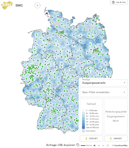
The interactive research tool developed by the Science Media Center Germany enables users to calculate travel times to hospitals and analyze healthcare accessibility. It is designed primarily for local and regional journalists investigating changes in hospital infrastructure, such as closures or reductions in services. The tool supports quick, location-based analyses to assess how such changes affect population coverage, whether accessibility standards are met, and how well nearby hospitals can compensate. For more comprehensive studies, additional data and code can also be provided. Overall, it helps users evaluate the impact of shifts in the healthcare system on regional medical access.
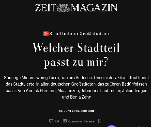
The interactive tool “Which neighborhood suits me?” helps users find the most suitable district in major German cities based on their personal preferences. By considering factors such as affordable rent, low noise levels, and proximity to amenities like swimming lakes, the tool matches users with neighborhoods that best fit their lifestyle and needs.
This study evaluates geographic accessibility to radiation oncology centers across Germany using spatial analysis and simulation. It identifies regional disparities and vulnerabilities in healthcare infrastructure, proposing a stress-testing framework for resilience planning.
The paper analyzes how logistics service providers can function as urban consolidation centers (UCCs) using a Düsseldorf case study. It shows that existing logistics locations can enable sustainable urban freight transport without requiring inner-city space, supporting proximity logistics and better land-use planning.
This work demonstrates the application of integrated network design guidelines for freight transport, focusing on German road networks and planning methodologies using geospatial datasets.
This paper presents a method to classify German road design standards within OpenStreetMap data. It improves the usability of OSM for transport planning and accessibility analysis by enriching road network attributes.